 Tribes 2
 20 · Bones’ Mapping Tutorial — Environment and finishing
Sky, fog, atmosphere, and the last pass before a map ships. Concluding 17–19.
Material marked [bones] is from NecroBones’ tutorial at
http://tribes.necrobones.com/tribes2/tutorial.html; map images are mirrored from it with attribution.
“This is the fun stuff. :) You can adjust the sky, fog, water, and sun to your heart’s desire, and the system is remarkably flexible, even compared to T1.” [bones]
Sky
Start by copying one
“look through the existing maps and find a sky that is close to what you want (perhaps it has clouds you like). You can manually copy the sky block out of the MIS file and replace the one in your mission. Or, you can write down the name of the dml object and copy it into the appropriate field, but the editor tends to not be fond of making such changes while running.” [bones]
Sky editing is a text-editor job more than an Inspector job. The same is true of water and fireballs (18 · The Creator).
The client can switch your sky off
The single most important constraint in this section [bones]:
“the background texture can be turned off by the client (as well as the clouds), as a performance option, so always remember to pick a background color that looks good on your map.”
Players on weak hardware disable sky textures. If your atmosphere depends on the texture, those players get a flat default and your map looks broken.
The author turned that constraint into a technique:
“You might even choose to leave it that way, since just a background color with clouds can make for a very customizable sky. That’s how I did the red and green skies in Hostility and Poison, respectively.” [bones]
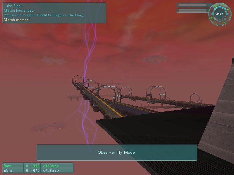
Hostility — NecroBones.
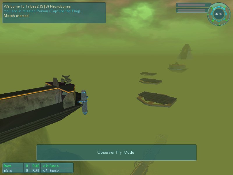
Poison — NecroBones.
Colour plus clouds, no background texture — cheap, robust, and it looks the same for everyone.
Fog
Visible and haze distance
“Haze distance is the distance at which the haze begins. Between that distance and the vis distance, objects and terrain will fade towards the fog color, which should closely match the predominant colors in the sky (with or without the textures). If they don’t match, that can be OK too, but things will look out of place if you don’t put in a thick fog layer.” [bones]
These are the same fields on TerrainBlock in the .mis — shipped maps use visibleDistance = "1200",
hazeDistance = "250" [script] (13 · Terrain).
Fog colour must match the sky, or the horizon reads as a seam.
The three fog layers
Precise, and documented nowhere else [bones]:
“The sky also controls fog layers. You can have 3 layers. “0 0 0” means the layer is turned off. The first number is the fog distance, the second is bottom of the layer (altitude), and the third is the top of the layer. Layers should never overlap, but they can be used together to make a gradual dropoff in the fog.”
| Field position | Meaning |
|---|---|
| 1 | Fog distance |
| 2 | Bottom altitude of the layer |
| 3 | Top altitude of the layer |
His worked example:
"100 0 100"      fog distance 100, altitude   0 → 100
"200 100 110"    fog distance 200, altitude 100 → 110
"300 110 120"    fog distance 300, altitude 110 → 120
“the fog will be at altitude 120 and down, but there will be multiple steps in how visually obscuring it is.” [bones]
Stacked non-overlapping bands give a gradient rather than a hard ceiling — thick at ground level, thinning with altitude. That is how you make a valley feel deep without fogging out the whole map.
An engine limitation to design around
“Unfortunately sometimes the terrain textures are still visible in the fog as a slightly different color because of limitations of the engine, and so certain colors will work well and others won’t.” [bones]
Test your fog colour against your terrain, not just against the sky.
Colour choice
“be sure to pick colors that look realistic and appropriate. For instance, the fog and sky in both Hostility and Poison (red and green, respectively) are technically primary colors, but they’re not pure primaries.” [bones]
Pure 255 0 0 reads as a rendering error. Desaturate and shift toward a plausible hue and the same idea
reads as atmosphere.
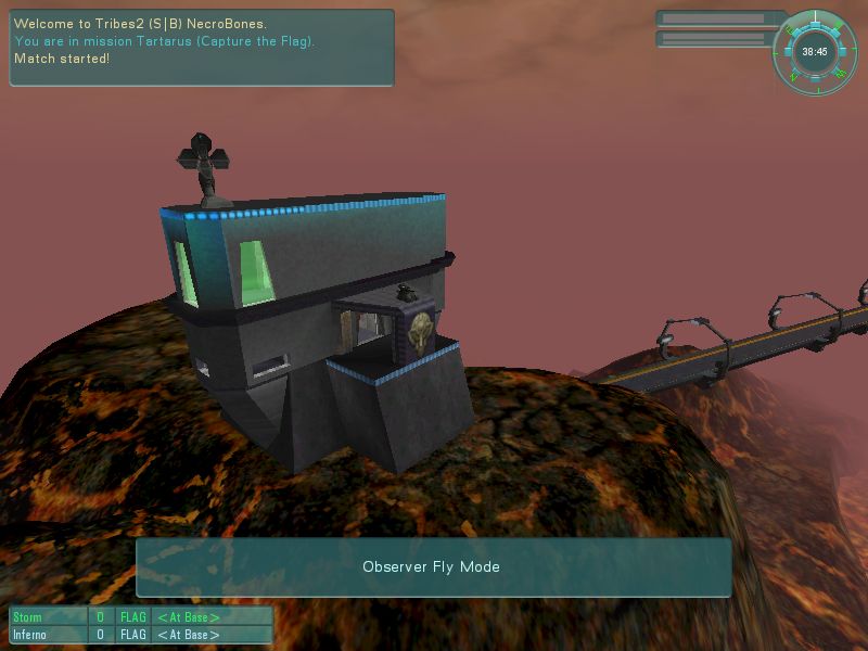
Tartarus — NecroBones.
Finishing touches
Visible distance is a framerate decision
“Did you choose a good visible distance? If this is too high, the framerate is going to suck for a lot of people… Tribes 2 wasn’t really designed with complex catwalks and so forth in mind, so if you have a lot of prefabs on the screen at once, framerate is going to go down. To compensate, you can shorten the visible distance and haze things down so it looks more foggy and the framerate stays higher.” [bones]
Fog is a performance tool as much as an aesthetic one. A dense, detailed map wants a shorter draw distance, and the fog that hides the cut-off is the same fog that gives it mood.
Eye candy
“You can put up banners on the walls, corpses in the field, packs and ammo to be found behind rocks… You can add trees, crashed vehicles, smoking debris, even additional capturable buildings.” [bones]
Packs and ammo hidden behind rocks is the one with gameplay consequences — it rewards exploration and gives the map’s dead space a reason to exist.
A custom load screen
Exact and easy to get wrong [bones]:
“take a decent screenshot of something unique to your map, and in a graphics program crop it down to 212x430 pixels, and save it in base/textures/gui as the mission-filename with a “load_” in front of it, in PNG format. For instance, if it’s called “mymission.mis”, then this image would be “load_mymission.png”.”
| Size | 212 × 430 |
| Format | PNG |
| Location | base/textures/gui/ |
| Name | load_<missionfilename>.png |
Note this is a client-side asset — it lives in the texture path and is not transmitted, so a server-side map (17) cannot ship one to players who do not have it.
Mission facts, quote, and signing your work
“You’ll want some interesting mission facts and a cool quote for the mission on the mission-load screen too. To edit these, open up the MIS file and edit them at the top… Don’t forget to sign your work… put your name on it and be proud of what you’ve made!” [bones]
These are the MISSION QUOTE and MISSION STRING blocks
(16 · Shipping a map) — hand-edited,
above the //--- OBJECT WRITE BEGIN --- marker so the editor does not overwrite them.
Mission area and vehicle ceiling
“adjust the mission-area so that it comfortably includes the entire battlefield and all buildings… It’s usually good to make it extend at least 100m behind the bases. Remember, the flags MUST stay within the mission area, so make it large enough that a flag-runner has some breathing room.” [bones]
And the ceiling:
“The mission-area block also contains the vehicle ceiling… I would recommend not making this any lower than 300… 500 is probably more comfortable, and 2000 effectively removes the restriction since it’s rare that anyone would try to fly so high.” [bones]
| Value | Effect |
|---|---|
| < 300 | Too restrictive |
| 500 | Comfortable |
| 2000 | Effectively unrestricted |
Worth comparing against Slapdash’s shipped flightCeiling = "240" [script] — Sierra went lower than
his recommendation, which tells you the setting is a genuine design lever rather than a default to copy.
The terrain-inside-buildings check
The deferred task from 19 · Placing a base [bones]:
“Remember when I had you click on the “show terrain inside building” checkbox… assuming you’ve exited and re-entered the mission, you should now be able to walk around to each building and see if there’s any terrain showing inside. If so, you need to fix it. You can mass-select the building and move it, or you can leave it as-is, or you can punch holes in the terrain.”
Punching holes is Set Empty in the Terrain Editor
(13 · Terrain) — and note that doing so writes
emptySquares into the .ter, which makes the map client-side
(17). On a server-side map, moving the
building is the only available fix.
The final pass
Combining his list with 16 · Shipping a map:
| Check | Why |
|---|---|
| Visible distance vs framerate | Playability on average hardware |
| Sky reads well with textures off | Many clients disable them |
| Fog colour matches sky and terrain | Horizon seams, engine colour limitation |
| Walk every building interior | Invisible terrain collision |
| Flags well inside the mission area | Flags must not leave it |
| Flight ceiling ≥ 300 | Aircraft usability |
| Load screen at 212×430 | Or you get the default |
| Quote, facts, and your name in the header | Attribution and polish |
| Spawn graph built | Spheres alone do nothing |
| Observer cameras placed and aimed | 3–6, green axis toward the action |
Related
- 17 · Getting started — the server-side technique and setup
- 19 · Building a base — power, objectives, pads, spawns
- 16 · Shipping a map — headers, packaging, what clients need
- 13 · Terrain — Set Empty, visible and haze distance